Experium is a Finnish drone and 3D reality-capture company delivering aerial and 3D data to the architecture, engineering, and construction sectors. We help keep projects safe, efficient, and moving at every stage of the lifecycle.
We use the power of geospatial data to support every stage of the project lifecycle. From planning and design to construction and long-term asset management, we help our clients plan better, build smarter, and manage with precision.
Experium reduces uncertainty in early project phases by providing site and environmental data that reduces risk, improves efficiency, and strengthens planning before work begins.
Our services help keep projects on schedule and within budget by documenting progress, verifying work, and helping teams spot issues early. This supports smoother coordination and keeps the job moving.
We help improve post-construction documentation that fills gaps left after the build, reduces safety risks, and prevents costly errors, supporting safe and efficient asset management.
At Experium, we believe that controlling data means controlling risk. We are committed to reducing the problems caused by incomplete or inaccurate data on every job.
We deliver actionable data that supports projects through every stage of their lifecycle. Our expertise in drone operations and 3D scanning allows us to capture entire sites, from terrain to infrastructure, above and on the ground. We provide comprehensive documentation solutions, including orthophotos, point clouds, 3D models, and volumetric analysis.
This gives project teams the reliable insight they need to design, build, inspect, and manage with confidence, minimizing risk, avoiding delays, and keeping projects on track.
Experium delivers aerial data that strengthens every stage of the project lifecycle. From early planning to construction execution and long-term asset management, our drone services provide the clarity needed to reduce uncertainty, improve safety, and enable more efficient, sustainable project delivery, while keeping projects moving forward.
We provide aerial data for:
Experium delivers 3D scanning services that transform how projects are documented, managed, and shared. From capturing existing conditions to supporting construction workflows and long-term facility operations, our scans provide the verifiable 3D documentation and comprehensive 3D models needed to keep teams aligned and reduce errors, delays, and rework.
We provide actionable 3D data for:
Experium consistently delivers precise geospatial data from both the air and ground by leveraging advanced drones, 3D LiDAR scanning, and standardized data processing workflows. Our end-to-end methodology ensures that every orthophoto, 3D model, and point cloud we deliver is accurate, compatible, and ready to use across different projects.
We operate wherever your project is, across Finland and the EU. We provide reliable drone imaging and 3D scanning services for projects ranging from single sites to wide-area developments. We guarantee consistent quality and delivery reliability across all locations.
Every project follows our clear and proven workflow. We use precise drone imaging and 3D documentation to capture highly accurate data, both from the air and inside buildings. Deliverables include orthophotos, 3D models, and point clouds that are immediately usable in design, documentation, and post-processing.
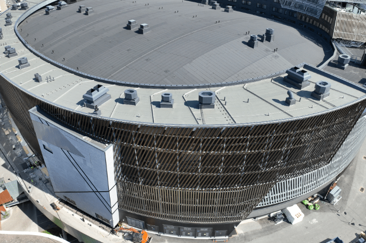
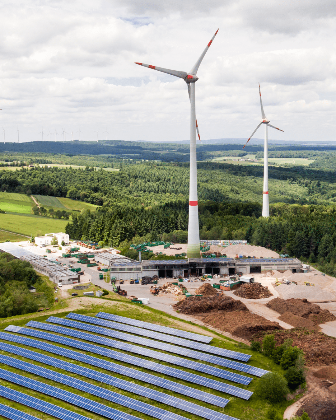
See how data collected from the ground and the air is transforming projects across Finland, giving clients the clarity to plan, build, and manage with confidence.
Experium provides drone and 3D scanning services across Finland and throughout the EU. From major cities to remote project sites, we deliver data quickly and efficiently. Contact us for a quote, and let’s find the right solution for your project.