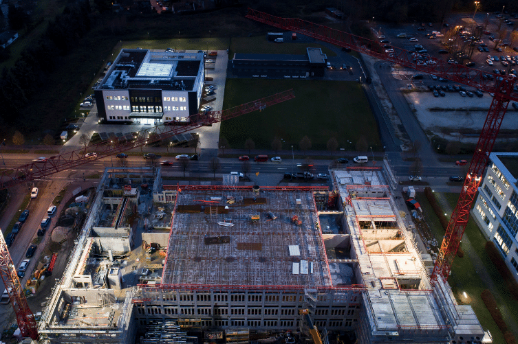
Experium provides drone monitoring and documentation services of construction sites in Finland, offering a complete visual record of site conditions, and progress throughout the build.
Instead of depending on what can be seen from the ground or trying to combine updates coming from different teams, a drone flight shows the whole site in one view. Seeing the construction area from above shows the layout and progress clearly as the work moves forward. This provides a clear advantage over older ways of progress monitoring. For progress monitoring, drone flights are:
Using a drone speeds up site surveying and reduces labour-intensive fieldwork. Each flight gives a comprehensive view of the project area, including places that are difficult or time-consuming to inspect on foot. The material is then organised into a structured report so teams no longer need to piece information together manually. Managers receive updates sooner, reducing the delay between when something changes on site and when they actually learn about it.
Drone images can be captured as often as the project needs, whether monthly, weekly, or daily. Each flight records the site from the same perspectives, locations, and altitudes, making progress straightforward to compare from one update to the next. Using consistent imagery across the project lifecycle improves productivity and helps stakeholders follow changes more efficiently.
In addition to being a safer way to document dangerous or difficult areas, drone flights can be launched at a fraction of the cost of helicopters or other aerial methods. This makes it practical to monitor important assets and construction zones regularly, including locations that would otherwise require special access or equipment to reach, helping construction projects stay within planned schedules and budgets.
Experium offers a comprehensive range of drone and 3D documentation services tailored for construction projects.
Recurring drone construction site monitoring to support schedule control and project communication.
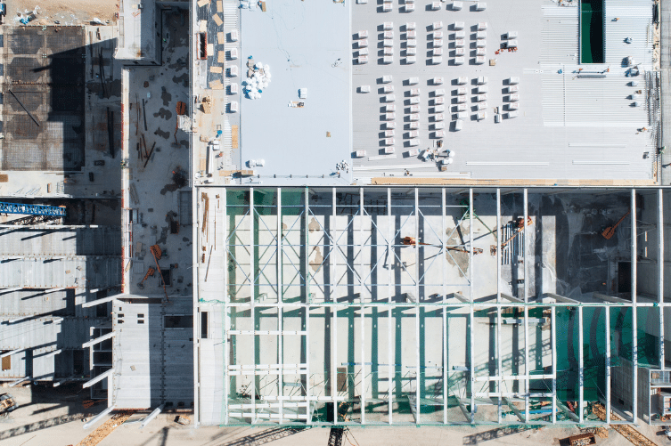
High-accuracy drone mapping for construction, infrastructure, and environmental projects.
Photogrammetric 3D models and point clouds for design and baseline documentation.
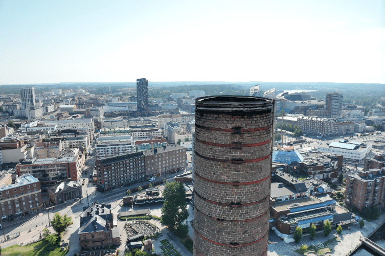
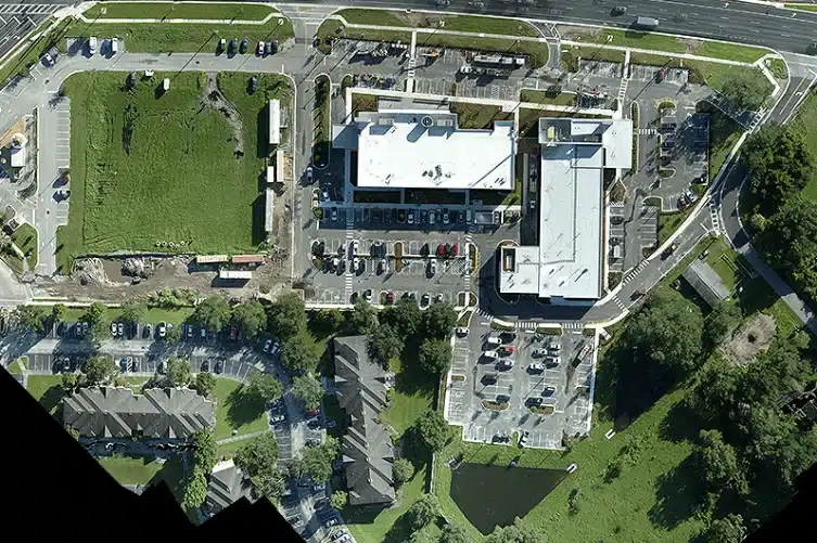
High-quality drone inspections for buildings, façades, roofs, towers, and industrial sites.
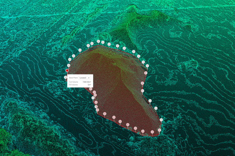
Drone volume calculations for earthworks materials and stockpiles.
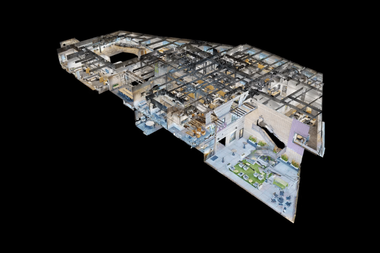
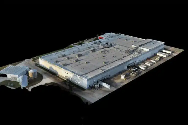
Matterport 3D scanning delivers accurate visual documentation for interior and exterior spaces.
Experium delivers drone data solutions that improve operational efficiency and project results across industries.
Enhance construction planning, documentation, and monitoring with drone imaging and 3D modeling. Orthophotos and point clouds assist in design, cost estimation, and site supervision, improving schedule management and resource efficiency.
High-resolution aerial images and thermal cameras enable precise visual inspections of power lines, insulators, and poles, allowing for the early detection of structural defects, hanging cables, and environmental risks such as fallen trees. Additionally, 3D modeling and orthophotos provide valuable data for the accurate design of new power plants, power lines, and other energy projects before construction, improving efficiency and reducing costs.
In industrial environments, precision and efficiency are key, with drone technology, extensive structural inspections can be conducted, the condition of production facilities can be monitored, and project management can be optimized without costly disruptions.
Drones bring a new level of accuracy and efficiency to the inspection of buildings and structures, improving maintenance, safety, and documentation without the need for costly and labor-intensive traditional methods.
Aerial images and 3D models assist in environmental monitoring and documentation. For example, changes in the condition of water areas and landscapes can be observed by comparing images taken at different times.
Experium operates in Finland, and our drone operators are professionally certified, compliant with Traficom regulations, and fully insured.
Experium provides drone and 3D scanning services across Finland, carrying out projects in Helsinki, Tampere, Turku, Jyväskylä, and throughout the country, wherever data is required.
We support projects in both urban environments and more remote locations. Please submit a description of your project — we will contact you within 24 hours.
For urgent enquiries, please call us directly.