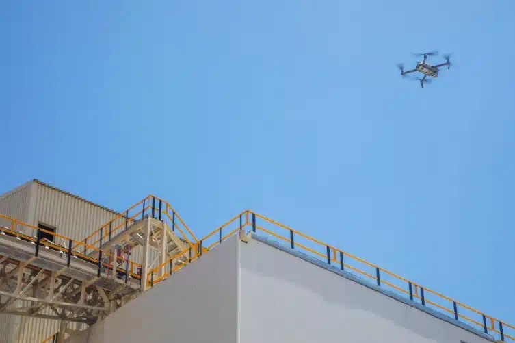
Construction projects often exceed budget and schedule. Track progress from the sky with aerial imagery from Experium and receive regular updates – weekly, monthly, or annually, to ensure your project stays on track.
Construction project management requires balancing schedules, budgets, and quality. Unexpected delays, challenges, and changes can affect the project at any stage.
Drone services for construction provides accurate, up-to-date aerial imagery to support the monitoring, oversight, and analysis of construction sites. They allow for quick and comprehensive site documentation, offering real-time information on project progress, material inventories, and site conditions. This technology helps keep schedules on track, reduce costly delays, and support better decision-making throughout the construction process.
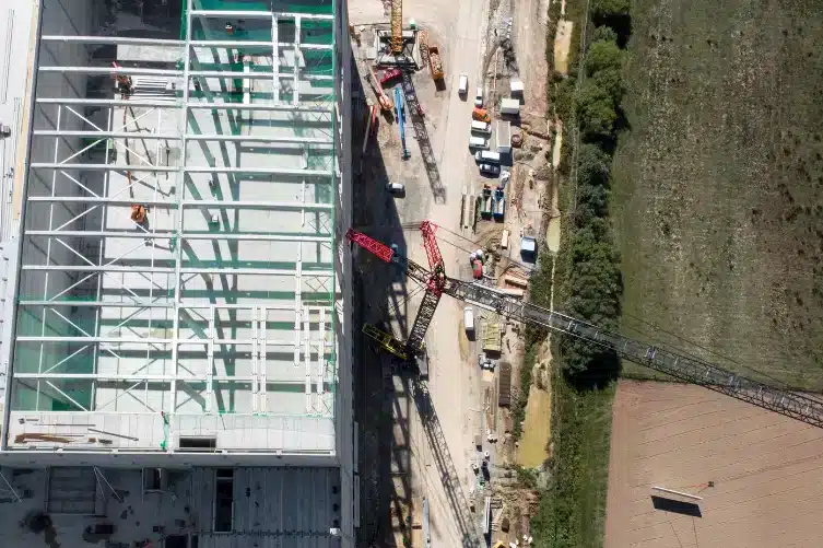
Drone services offer precise aerial imagery to help monitor construction projects in real-time. By capturing high-quality photos and videos, drones allow for efficient progress tracking, site inspections, and quick updates on material and labor status. This technology improves oversight, reduces the risk of delays, and ensures the project stays within budget and schedule.
Additionally, drones can create 3D models, making site mapping and tracking even more cost-effective.
Our drone services for the construction industry offer several benefits:
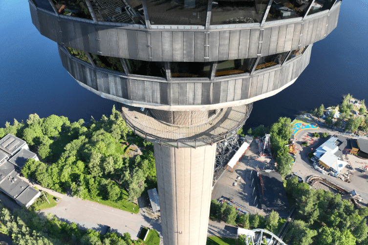
Aerial photography provides a continuous and high-quality view of the construction site, which is essential for construction professionals at every stage of the project. Drones simplify data collection and processing, giving you the exact resources you need to achieve your goals. With drones, site monitoring, reporting, and decision-making become more efficient than ever.
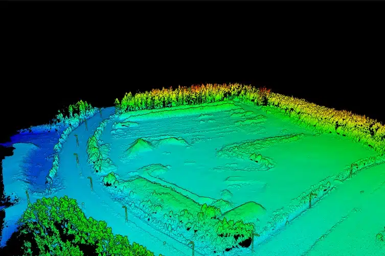
Traditional mapping is not always cost-effective or time-efficient. However, drones can quickly gather data over large areas and create maps that reveal terrain details to support better construction planning. This speeds up the mapping process while reducing both time and costs.
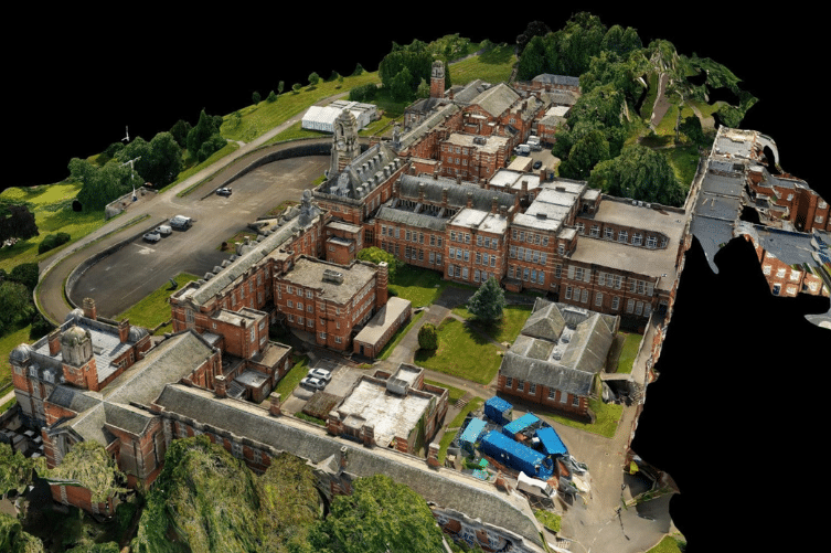
High-resolution aerial images create precise 3D models that help the team identify potential challenges and design flaws, preventing resource wastage. These 3D models keep the team aligned with the original plan and provide clients with a clear vision of what the finished project will look like.
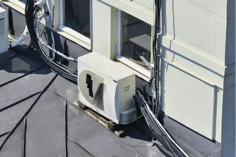
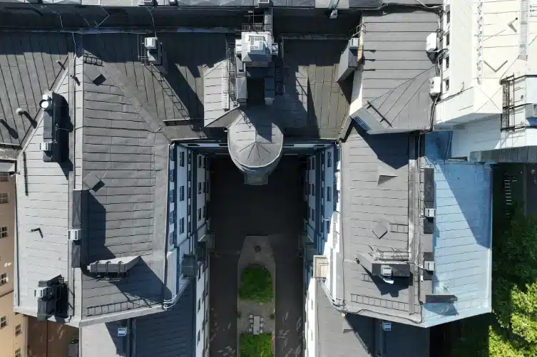
Drone inspections are safer and more efficient than traditional manual inspections. Drones capture precise aerial images and data, which are quickly sent to decision-makers who can address issues immediately or store the information for future assessments.

Drone 360 virtual tours provide a comprehensive and interactive 360° view of the construction site and surrounding landmarks, giving clients and investors a detailed understanding of the project.

Drone aerial photography offers high-quality content for marketing images and videos. Showcase your project digitally to potential buyers and promote your work through various marketing channels.
Regardless of your industry, Experium helps you leverage drone technology for more efficient work and better results.
Precise 3D modeling and orthophotos provide a comprehensive view of forests and fields, while monitoring the condition of forest roads, ditches, and fences helps maintain infrastructure efficiently.
Enhance construction planning, documentation, and monitoring with drone imaging and 3D modeling. Accurate orthophotos and point clouds assist in design, cost estimation, and site supervision, improving schedule management and resource efficiency.
High-resolution aerial images and thermal cameras enable precise visual inspections of power lines, insulators, and poles, allowing for the early detection of structural defects, hanging cables, and environmental risks such as fallen trees. Additionally, 3D modeling and orthophotos provide valuable data for the accurate design of new power plants, power lines, and other energy projects before construction, improving efficiency and reducing costs.
In industrial environments, precision and efficiency are key – with drone technology, extensive structural inspections can be conducted, the condition of production facilities can be monitored, and project management can be optimized without costly disruptions.
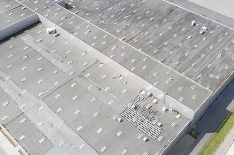
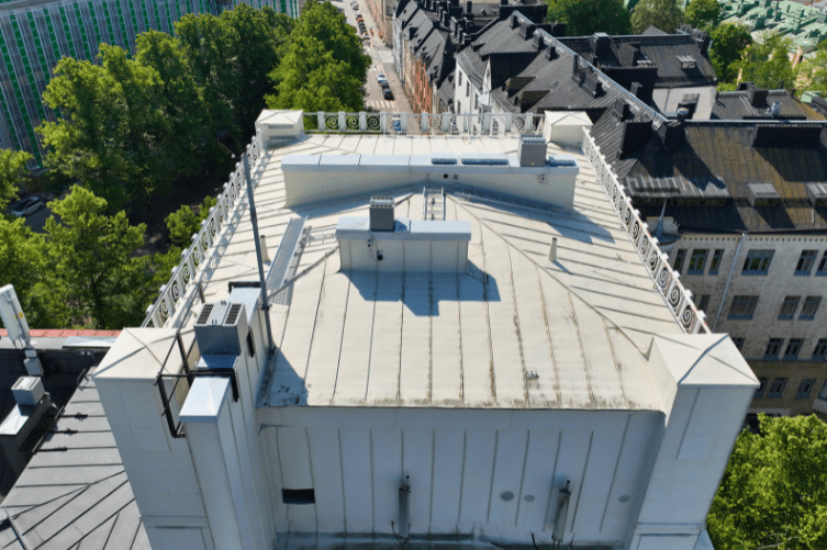
Drones bring a new level of accuracy and efficiency to property and structure inspections, improving maintenance, safety, and documentation without the costly and labor-intensive traditional methods.
Aerial images and 3D models assist in environmental monitoring and documentation. For example, changes in the condition of water areas and landscapes can be observed by comparing images taken at different times.
Experium is based in Finland and operates across the EU, with drone operators who are professionally certified and comply with EU regulations.
Experium isn’t just a provider, we’re a partner in precision. Our drone and 3D scanning services help keep your projects on schedule, on budget, and on target.
Accurate aerial data, including videos, photos, site documentation, inspections, and progress monitoring.
High-precision 3D models of buildings and sites. Widely applicable for design, visualization, monitoring, and documentation needs.
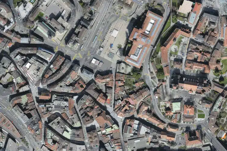
Accurate orthophotos and maps of areas and terrain. Suitable for construction and infrastructure projects, planning, and land management.
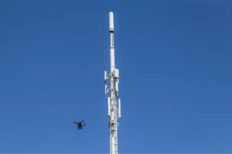
Accurate aerial photos and video material of structures and assets, such as roofs, façades, chimneys, and communication towers.
3D models of buildings, built and natural environments, providing digital twins that support planning, monitoring, and visualization across the entire project lifecycle.
Experium provides drone and 3D scanning services across Finland, carrying out projects in Helsinki, Tampere, Turku, Jyväskylä, and throughout the country, wherever data is required.
We support projects in both urban environments and more remote locations. Please submit a description of your project — we will contact you within 24 hours.
For urgent enquiries, please call us directly.