Turn aerial data into project clarity with Experium’s drone data services, delivering the clarity needed to plan, build, and manage with insight.


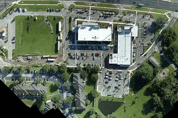
Comprehensive drone mapping for land use, infrastructure, or construction needs.

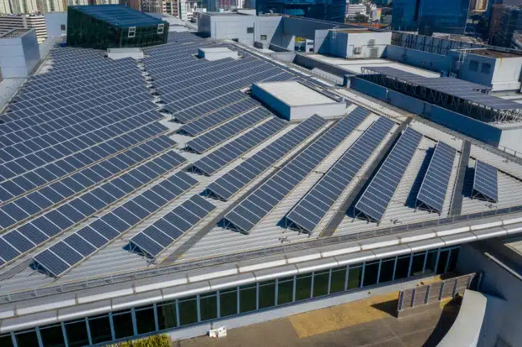
Safe and detailed roof inspections without ladders or scaffolding.

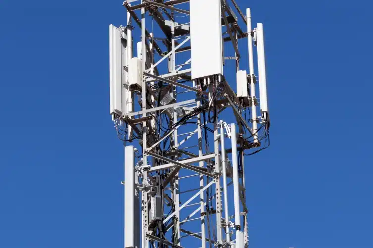
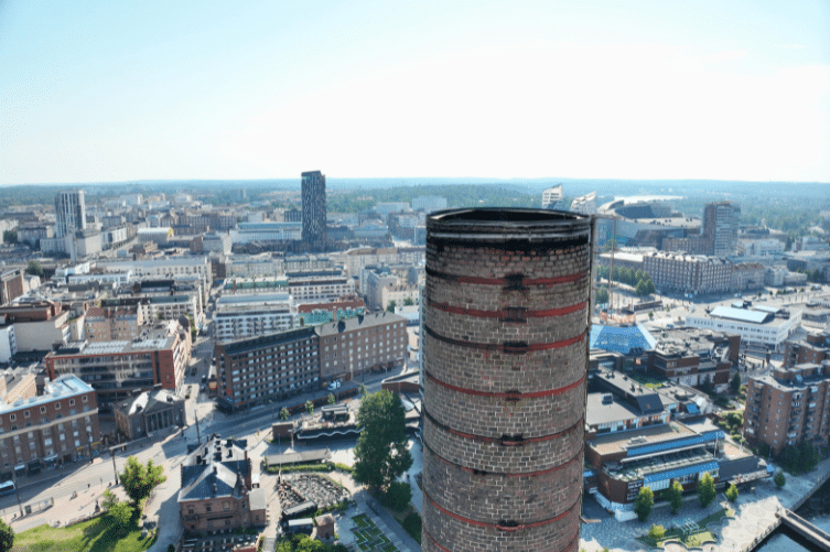
Fast and comprehensive inspections for masts, antennas, and other tall structures.

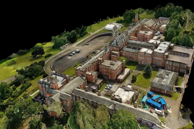
Photogrammetry 3D modeling of buildings and areas from aerial imagery.

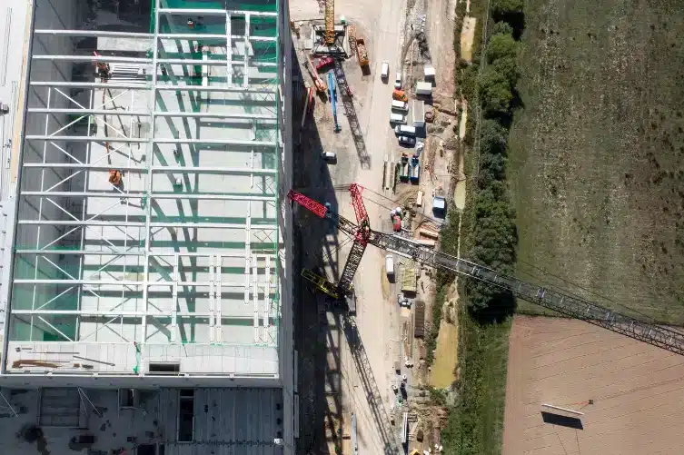
Daily, weekly, or monthly aerial captures for documenting construction progress.

Aerial photography for planning, inspections, and reporting needs.

High-resolution, georeferenced orthophotos of sites and structures.

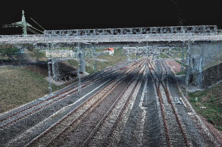
Dense 3D point cloud data from photogrammetry for detailed site and structural analysis.

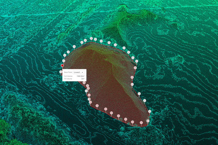
Volume measurement for stockpiles and construction sites.
From early site documentation through construction, handover, and post-project inspections, Experium delivers data that supports the entire project lifecycle.
New construction, renovation, and refurbishment projects, including design–build and infrastructure contracts, from planning through construction and handover.
Baseline data and existing conditions documentation for planning and consulting projects, supporting coordination, analysis, and decision-making.
Public sector assets, including municipalities, cities, hospitals, and other public infrastructure, requiring reliable documentation of existing and as-built conditions for renovation projects, construction works, and lifecycle maintenance.
Design and engineering projects requiring existing-conditions data of buildings and site environments to support new construction and renovation projects.
Energy production and distribution assets, including power plants, electrical networks, and energy infrastructure, used for planning, maintenance, and infrastructure upgrades.
Industrial and production environments, including factory sites, process facilities, and logistics facilities, supporting planning, modifications, and refurbishment works.
Buildings and property portfolios supporting inspections, renovation projects, and lifecycle asset management.
Experium provides drone and 3D scanning services across Finland, carrying out projects in Helsinki, Tampere, Turku, Jyväskylä, and throughout the country, wherever data is required.
We support projects in both urban environments and more remote locations. Please submit a description of your project — we will contact you within 24 hours.
For urgent enquiries, please call us directly.