Analyze, model and visualize your site with ultra-high-definition digital models from Experium, providing clear insight into the reality of present conditions.
Drone 3D modeling is a geospatial data collection method used to produce measurable 3D digital models of real-world built environments, such as buildings, structures, terrain, and large areas. The process is based on a drone capturing overlapping, highly detailed imagery from all directions, which is then processed in software into an accurate and dimensionally consistent 3D model that can be used for planning, documentation, and project monitoring. Drone 3D modeling offers several advantages over traditional methods:
Data from above = better control on the ground. Drone 3D modeling reduces risks, saves time, and ensures smooth project progress.
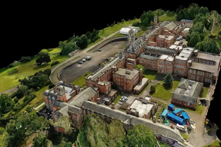
A textured mesh model combines aerial imagery and point cloud data collected simultaneously, resulting in a highly detailed 3D digital surface model with photorealistic texture. This hybrid dataset provides a more accurate and coherent representation than an image-based model alone, making mesh models an excellent tool for urban planning, analytics, infrastructure optimization, and site modeling.
A point cloud is a foundational dataset for 3D modeling, consisting of millions of coordinate points that represent the geometry of an object or environment in a highly detailed and measurable form. Point clouds are suitable for use as base data for design, measurements, documentation, and further processing in CAD and 3D software.
Whether you’re in construction, energy, or another sector, Experium helps you leverage drones for smarter, more efficient operations.
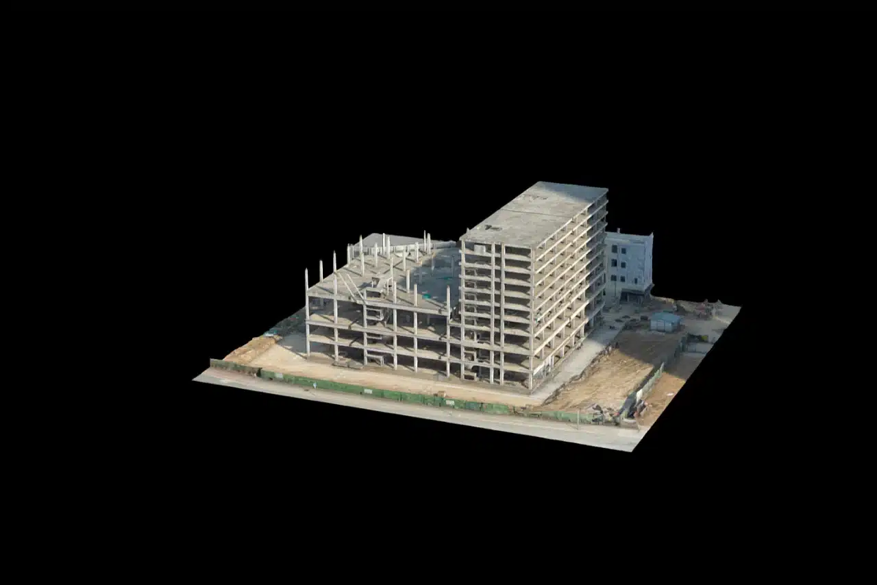
A 3D model in the construction industry enhances project visualisation, improves earthworks calculations/projections, streamlines communication, and improves decision-making by providing stakeholders with an accurate and detailed representation of the project. This helps planning, coordination, and identifying potential issues before they arise.
A 3D model serves as an accurate, measurable base dataset that speeds up the design process and reduces the need for manual measurements. It helps minimize errors and provides a reliable foundation for planning renovation, modification, and new construction projects.
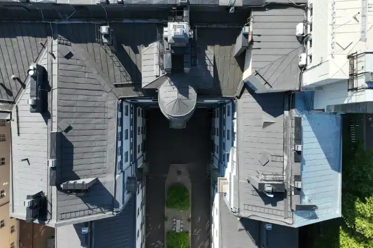
A 3D model provides an accurate and visually clear digital representation of structures, making remote analysis and visual inspection easier. It enables the identification of damage, documentation of findings, and improved efficiency and safety in inspection workflows, without unnecessary site visits.
A 3D model in the energy sector supports the planning, construction, and maintenance of critical infrastructure such as solar farms, wind turbine sites, and electrical substations. It enables visual assessment of sites, monitoring of structural condition, and more effective planning and documentation of maintenance activities.
A 3D model provides a detailed understanding of terrain shapes, elevation changes, and structural features across a site, enabling more accurate assessments for planning and land-use decisions. It supports efficient analysis of topography, boundaries, and zoning requirements with greater precision than traditional survey methods.
3D models help track long-term changes in terrain, water areas, and vegetation. They provide valuable data for assessing project impacts, supporting restoration and remediation work, and documenting environmental change over time.
Experium is based in Finland and operates across the EU, with drone operators who are professionally certified and comply with EU regulations.
Experium isn’t just a provider, we’re a partner in precision. Our drone and 3D scanning services help keep your projects on schedule, on budget, and on target.
Accurate aerial data, including videos, photos, site documentation, inspections, and progress monitoring.
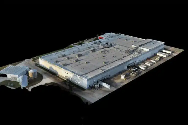
High-precision 3D models of buildings and sites. Widely applicable for design, visualization, monitoring, and documentation needs.
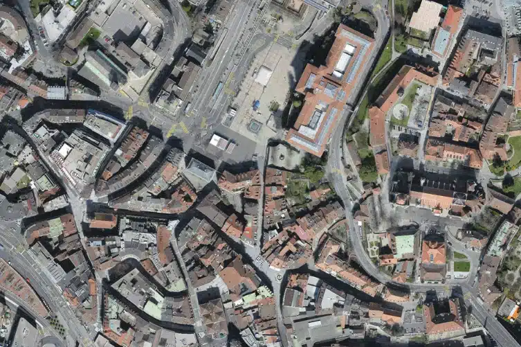
Accurate orthophotos and maps of areas and terrain. Suitable for construction and infrastructure projects, planning, and land management.
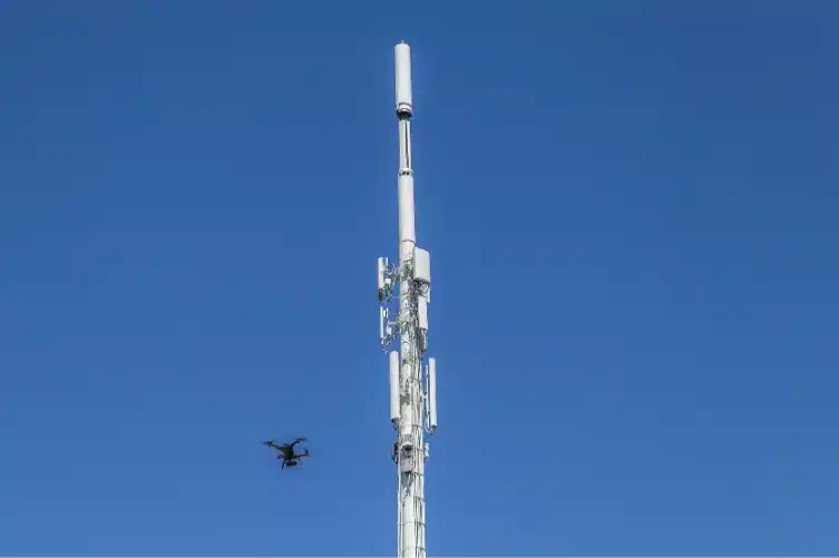
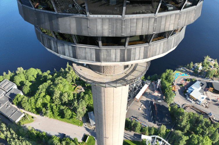
Accurate aerial photos and video material of structures and assets, such as roofs, façades, chimneys, and communication towers.
3D models of buildings, built and natural environments, providing digital twins that support planning, monitoring, and visualization across the entire project lifecycle.
Experium provides drone and 3D scanning services across Finland, carrying out projects in Helsinki, Tampere, Turku, Jyväskylä, and throughout the country, wherever data is required.
We support projects in both urban environments and more remote locations. Please submit a description of your project — we will contact you within 24 hours.
For urgent enquiries, please call us directly.