Experium provides high-resolution orthophotos, 3D point clouds, and scheduled progress documentation for construction and infrastructure projects.
Drone mapping uses UAV systems equipped with high-precision GNSS positioning. These systems capture thousands of data points that are processed into detailed point clouds, accurate 3D models, and comprehensive terrain maps. For land development planning, construction progress tracking, and earthwork management, drone mapping is significantly more efficient, faster, and safer than traditional surveying methods.
Aerial data = better control on the ground. Drone mapping reduces risks, saves time, and keeps your project moving forward.
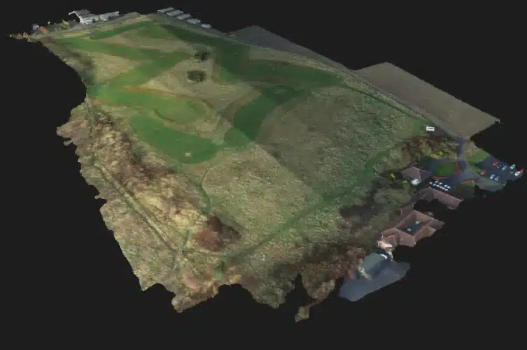
Detailed terrain mapping with photogrammetry for planning, design, and general site analysis. Best suited for cleared land areas, active construction sites, and earthwork monitoring throughout a project’s lifecycle.
With regular drone flights, your construction site becomes a clear visual timeline that documents site conditions and construction progress in real time.
Experium isn’t just a provider, we’re a partner in precision. Our drone and 3D scanning services help keep your projects on schedule, on budget, and on target.
Accurate aerial data, including videos, photos, site documentation, inspections, and progress monitoring.
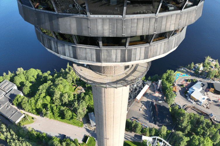
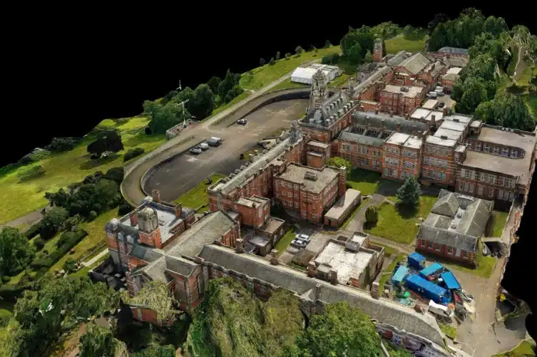
High-precision 3D models of buildings and sites. Widely applicable for design, visualization, monitoring, and documentation needs.
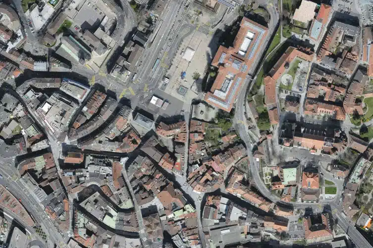
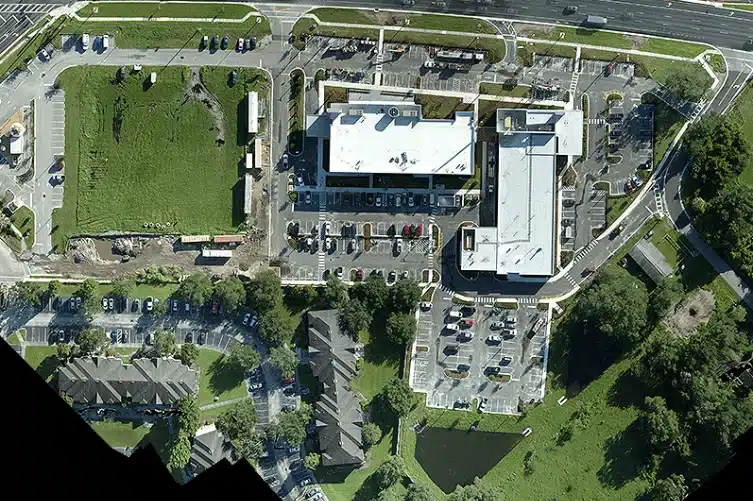
Accurate orthophotos and maps of areas and terrain. Suitable for construction and infrastructure projects, planning, and land management.
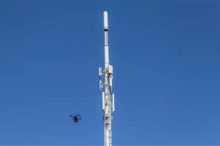
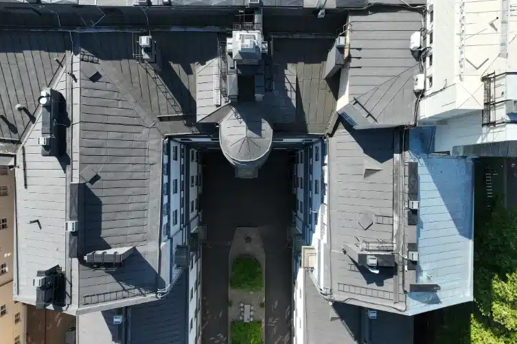
Accurate aerial photos and video material of structures and assets, such as roofs, façades, chimneys, and communication towers.
3D models of buildings, built and natural environments, providing digital twins that support planning, monitoring, and visualization across the entire project lifecycle.
Experium provides drone and 3D scanning services across Finland, carrying out projects in Helsinki, Tampere, Turku, Jyväskylä, and throughout the country, wherever data is required.
We support projects in both urban environments and more remote locations. Please submit a description of your project — we will contact you within 24 hours.
For urgent enquiries, please call us directly.