From quarries to construction sites, Experium delivers precise stockpile volume measurements and volumetric surveys in a fraction of the time. Faster, safer, and more cost-effective than traditional survey methods.
Managing excavation and stockpiles is a constant challenge for quarries and mining sites. Accurate volumetric surveys reduce safety risks and provide reliable data to monitor material movement, track output, and maintain precise inventory records. Experium supports operators with consistent reporting that improves planning and operational efficiency.
Cut-and-fill analysis and excavation tracking are critical for keeping construction projects on schedule and within budget. Volumetric surveys deliver repeatable data across large areas, helping contractors control costs, improve documentation, and reduce the risk of overruns. Experium ensures that progress is measured accurately throughout the project lifecycle.
Ports, warehouses, and storage facilities rely on precise measurements to manage bulk goods such as sand, gravel, and grain. Drone-based volumetrics provide fast, repeatable results that support inventory management, regulatory reporting, and material handling. Experium delivers reliable data that minimizes manual errors and streamlines day-to-day operations.
Accurate measurement of quarry volume helps in planning mining operations, monitoring the amount of excavation, and controlling stockpiles.
Drones can accurately calculate the volume of bulk cargo, such as grains, sand, gravel, and more.
Technology allows for the precise estimation of the volume of excavated earthworks, such as peat, clay, or sand.
Drones can be used to locate and assess new mineral resources, such as sand or gravel deposits.
Accurate soil volume measurement at construction sites aids in project planning, material quantity estimation, and cost control.
Measuring volumes is step one…
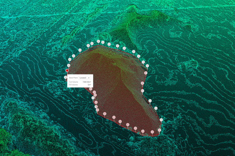
Drone volumetric surveys provide accurate measurements of stockpiles, excavations, and earthworks in a fraction of the time required by traditional methods. Typical calculations achieve accuracy within 1–3% of traditional ground surveys, removing guesswork and costly miscalculations. By eliminating the need for staff to climb piles or walk hazardous sites, safety risks are also significantly reduced.
Step two is putting the data to work. That’s where Experium delivers real value.
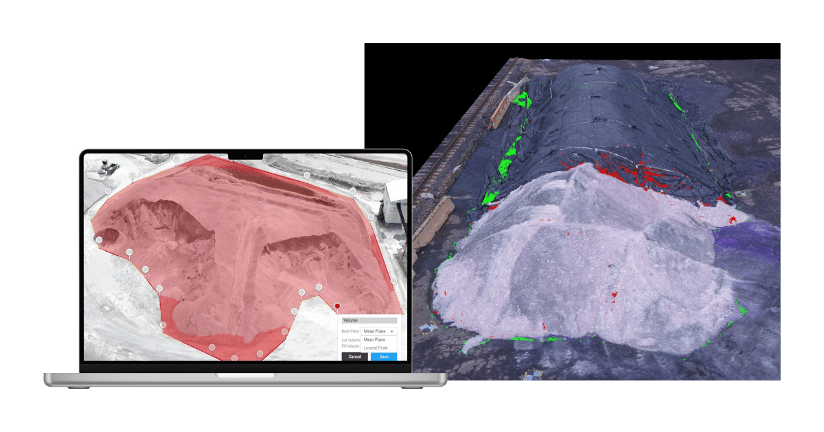
Because our team specializes in aerial data collection and volumetric data processing, Experium delivers more than raw numbers. Every survey is transformed into clear, ready-to-use outputs such as volume reports, annotated orthophotos, cut-and-fill calculations, and 3D surface models. These deliverables support planning, cost control, and project tracking across industries from quarrying and mining to construction and bulk material logistics.
Deliverables you can use immediately.
Every volumetric survey includes exportable data packages such as:
All deliverables are provided in industry-standard formats, making them easy to share with project teams, clients, and regulators. For engineering-driven projects, results can also be supplied in CAD- and GIS-compatible formats for seamless integration into existing workflows.
It is a modern method where a drone equipped with RTK technology and photogrammetry software is used to create a precise 3D model of an object. From this model, it is possible to accurately calculate the volume of various materials, such as soil, sand, gravel, or other bulk cargo.
This technology can be used to measure various objects: quarry excavations, quantities of bulk cargo (grain, sand, gravel), soil stockpiles on construction sites, and peat or clay excavations. The method is also applied for the exploration of new land resources, such as sand or gravel deposits.
The accuracy of volumetric surveys depends ont eh technology and methodoligies employed. At Experium, we use industry-leading equipment and techniques to ensure the highest level of accuracy possible and integrate data from multiple sources:
Volumetric surveys are valubale for a wide range of industries including:
Volumetric surveys provide an independent and objective method for measuring quantities of materials (e.g., quarry operators, earthworks contractors).
By establishing agreed-upon volumes through accurate surveys, all parties can trust billing and payments. Professional and impartial volumetric survey services ensure transparency in material quantification.
Experium isn’t just a provider, we’re a partner in precision. Our drone and 3D scanning services help keep your projects on schedule, on budget, and on target.

Accurate aerial data, including videos, photos, site documentation, inspections, and progress monitoring.

High-precision 3D models of buildings and sites. Widely applicable for design, visualization, monitoring, and documentation needs.

Accurate orthophotos and maps of areas and terrain. Suitable for construction and infrastructure projects, planning, and land management.
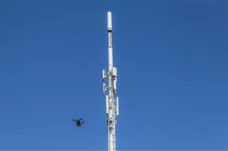
Accurate aerial photos and video material of structures and assets, such as roofs, façades, chimneys, and communication towers.
3D models of buildings, built and natural environments, providing digital twins that support planning, monitoring, and visualization across the entire project lifecycle.
Experium provides drone and 3D scanning services across Finland, carrying out projects in Helsinki, Tampere, Turku, Jyväskylä, and throughout the country, wherever data is required.
We support projects in both urban environments and more remote locations. Please submit a description of your project — we will contact you within 24 hours.
For urgent enquiries, please call us directly.