Digitize buildings and interior spaces with Matterport 3D scanning services. Experium delivers E57 point cloud files and detailed 3D walkthroughs to support documentation, coordination, and progress tracking.
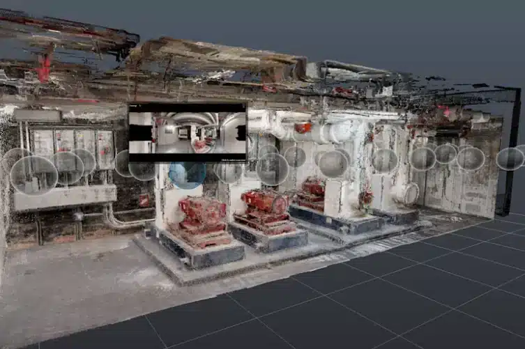
Experium provides 3D laser scanning services using Matterport imaging technology for documenting buildings, interior spaces, and technical areas. The scanning process produces clear visual material and dense spatial data of rooms, structures, and equipment, using a safe, non-intrusive capture method.
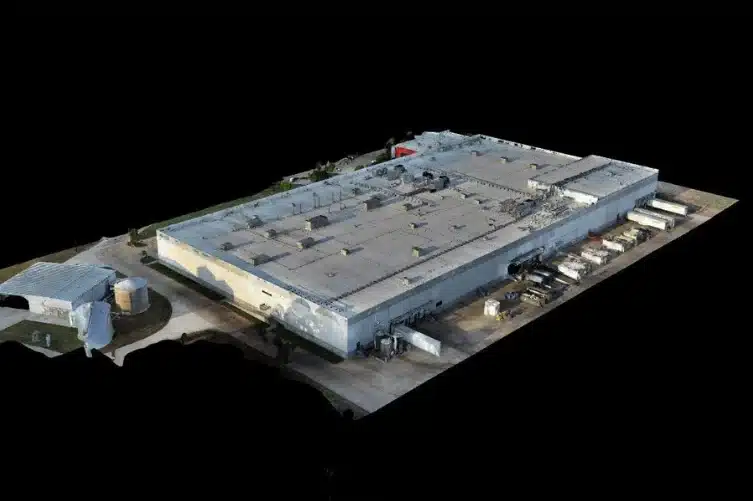
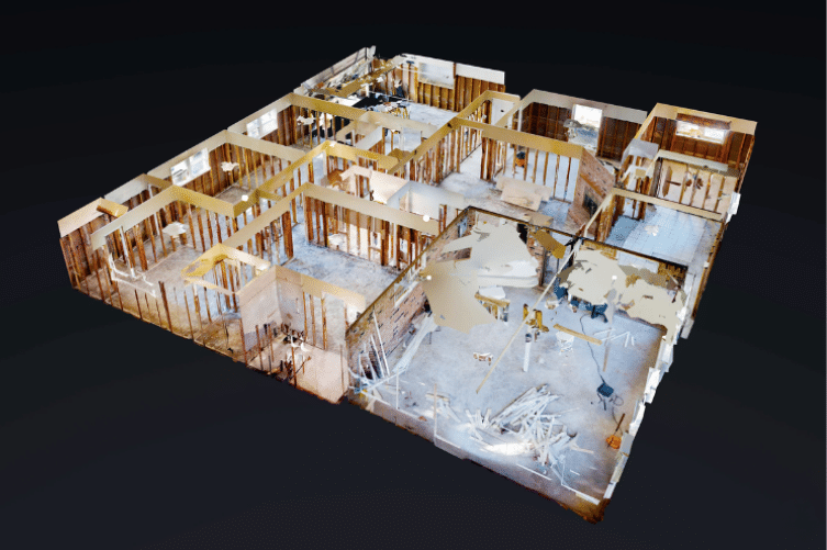
Matterport spatial scanning is used in architecture, design, and construction projects to support renovation planning, assess existing conditions, monitor construction progress, and document facilities. The resulting data, including the interactive 360° virtual tour and the colorised E57 point cloud, captures the current state of the building and serves as a consistent reference dataset throughout the entire project.
Experium’s 3D LiDAR scanning services provide clients with as-built documentation of buildings and infrastructure using Matterport Pro3 LiDAR technology. The deliverables include point cloud datasets that enhance project planning, construction, and asset management.
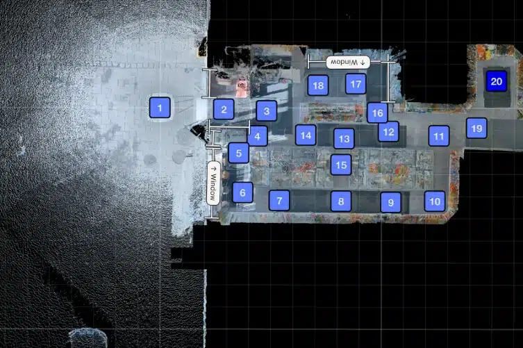
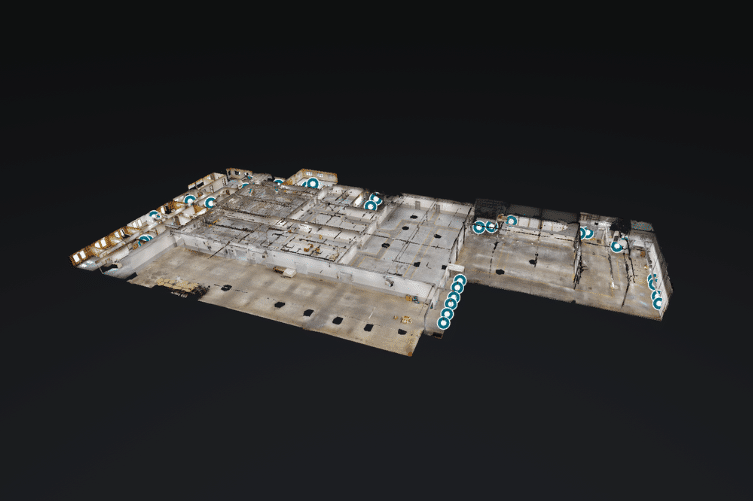
3D-rendered scans enable virtual tours, point clouds (E57), mesh models, and the creation of simple 2D and 3D floor plans for visualization. These outputs can be used for design, documentation, and spatial analysis.
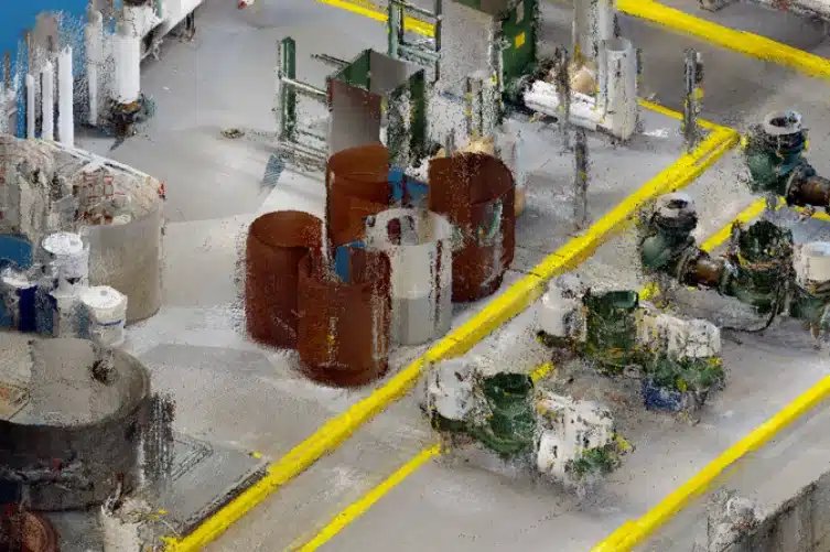
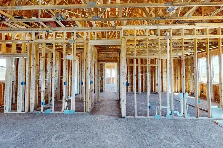
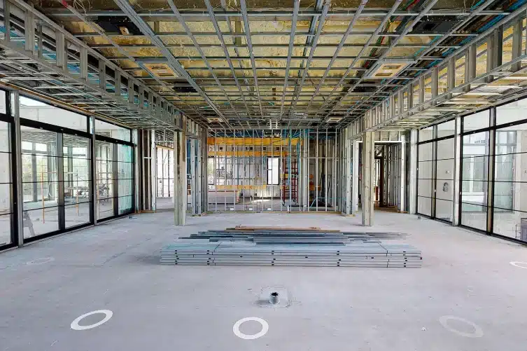
Scans produced with Matterport Pro3 include high-density point clouds (E57), offering sufficient measurement accuracy (typically 20 mm) for space planning, as-built documentation, and architectural modeling. This data serves as a valuable foundation for 3D BIM workflows and spatial inspections.
Matterport Pro3 scanning generates documentation based on point clouds and mesh models, making it suitable for precise 3D documentation of existing structures. The datasets support as-built registers, design coordination, and facility management. The technology enables effective visualization of buildings, technical spaces, and production environments at different stages of a project.
Experium provides solutions for every stage of your project lifecycle.
Experium provides accurate as-built documentation of existing structures and systems, capturing exactly what has been built. We deliver visual 3D models and E57 point cloud datasets to support design, inspection, and maintenance, quickly and without disruption.
A precise understanding of the existing state is essential for successful planning. Experium produces measurable and visually clear virtual models of existing structures, which can be used in HVAC, electrical, and plumbing (MEP) design, space modification planning, and 3D model-based collaboration.
Managing facilities and planning future modifications requires up-to-date information on what has actually been built. Experium delivers permanent, easily accessible 3D models that serve as a reliable reference for maintenance, renovation, and modernization projects. Matterport Pro3 captures structures and technical systems as virtual documentation that can be reviewed anytime, anywhere.
Project success requires clear communication and up-to-date information. Experium provides a centralized view of the construction site, allowing designers, contractors, and clients to stay aligned through a single virtual model. This speeds up decision-making and reduces unnecessary site visits.
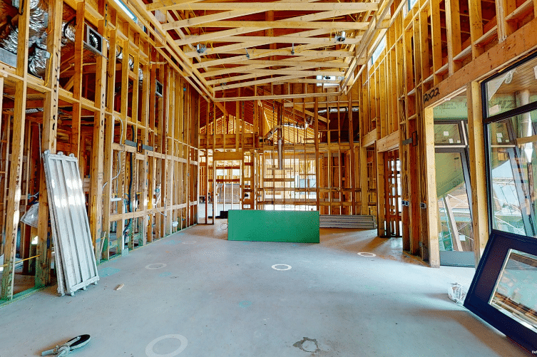
Technical systems and critical details become hidden once covered. Experium captures spaces and equipment visually before closure, creating permanent records that can be used for maintenance, inspections, and future modifications.
A site’s status does not always require physical presence. Experium enables spaces to be reviewed and measured remotely via browser access. With the virtual model, details can be inspected, progress documented, and issues resolved without unnecessary visits.
Eliminate uncertainty in renovation and modification projects by providing architects, engineers, and contractors with an accurate 3D view of the current site conditions. The scans visualize structures, surface markings, and installation points, reducing guesswork about drilling, cutting, and connection locations.
Avoid errors and design conflicts that can lead to costly changes and delays. With the virtual model, all project stakeholders, both on-site and remote, can use the same visual data from the very beginning for more precise planning, coordination, and decision-making.
Capture site progress accurately at every stage. Experium’s regular 3D scans help compare construction against design plans, verify completed work, and document for payment schedules and reporting purposes, including as evidence in case of disputes.
Verify completed work, approve modifications, and perform measurements directly within the digital model. Progress can be tracked seamlessly in the virtual environment, whether the team is on-site or connected remotely from multiple locations.
Give stakeholders, contractors, and designers access to the project’s virtual model, showing markings, routes, and structures before work begins. Completed site models allow remote walkthroughs to support handovers, approvals, and commissioning phases.
Experium’s 3D model acts as an active communication tool for the construction site. Observations, questions, and RFIs can be added directly into the model, along with supporting documents or clarifications, and assigned to the right stakeholders. This reduces uncertainty, speeds up decision-making, and keeps projects on schedule, even with remote collaboration.
Accurate 3D documentation helps property owners and facility managers oversee their assets more efficiently in the following use cases:

Keep building conditions up to date with a virtual 3D model. Visual documentation supports designers, engineers, and service providers in planning upgrades and renovations without disrupting operations.
The 3D model serves as a visual reference for periodic inspections and maintenance planning. Asset condition can be assessed remotely, service history recorded, and measurements taken without a site visit. Notes, instructions, and task lists can also be added directly to the model.
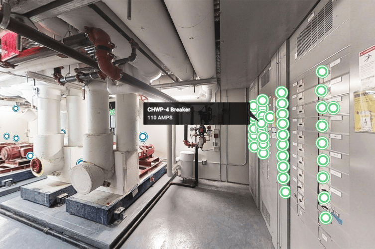
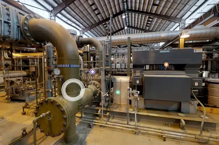
Building systems, panels, and equipment are easily accessible through the virtual model. Technical components, such as valves, breaker panels, HVAC, and other MEP systems, can be tagged and labeled directly in the model, speeding up maintenance and reducing errors.
Reliable 3D documentation and geospatial data are essential throughout the entire lifecycle of an asset, from planning and construction to use and maintenance. Experium converts the data collected into actionable data that helps organisations plan smarter, build more efficiently, and manage their assets with confidence.
Experium provides 3D documentation and geospatial data for all phases of construction and infrastructure projects. Digital documentation supports project teams in verifying schedules and work stages, improves accountability, and strengthens coordination by capturing:
The resulting 3D data and visual as-built models improve collaboration between the site and remote teams, providing a verifiable digital record of the built environment.
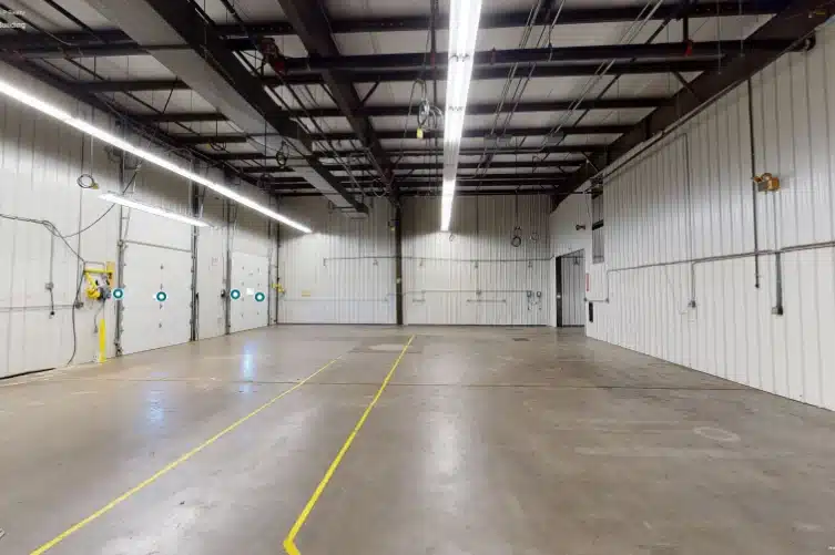
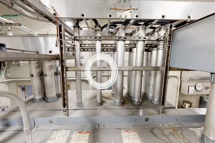
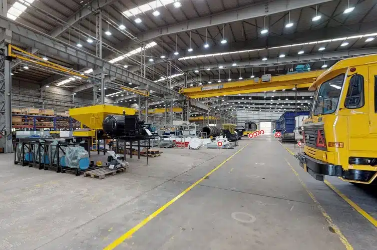
Experium provides 3D documentation of industrial environments efficiently and safely. By using a non-intrusive capture method, we collect accurate 3D data and geospatial information that supports space planning, maintenance planning, and operational efficiency.
After data collection, Experium delivers interactive 3D models, as-built documentation, and virtual walkthroughs that support planning, safety assessments, and future modifications, preserving a reliable digital record of the built environment.
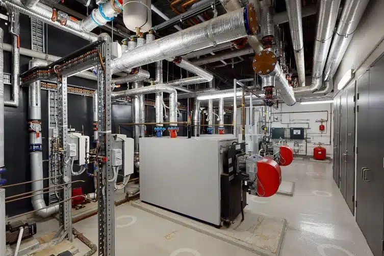
Experium provides comprehensive digital data to support the management of energy and infrastructure assets. High-accuracy 3D documentation and geospatial information give operators and engineers measurable insights into structural condition and performance. The data supports inspections, maintenance planning, and lifecycle management by capturing:
The resulting 3D data improves situational awareness, optimises maintenance planning, and maintains a consistent and verifiable digital record of the built environment.
Experium provides 3D documentation of built environments such as offices, commercial spaces, and large retail buildings, serving property owners, asset managers, and investors. Structures and systems are digitised and documented for the following use cases:
After scanning, Experium converts the collected reality-capture data into 3D models, interactive virtual walkthroughs, and as-built documentation that includes floor plan layouts as well as interior and exterior elements with their locations. This creates a comprehensive and reliable digital record of the built environment.
Experium provides 3D documentation and digital modeling for public-sector and institutional facilities. The resulting digital data supports planning, maintenance, and asset management while preserving a permanent digital record of the built environment. Documentation covers, among others:
The resulting as-built documentation, virtual 3D models, and geospatial data support maintenance planning, asset monitoring, and lifecycle management, providing a long-term, verifiable digital record of public infrastructure.
Experium provides accurate 3D documentation and digital modeling of transportation infrastructure and operational facilities. The data supports maintenance planning and safety assessments by delivering reliable visual information on current conditions. The resulting 3D data forms a long-term digital record of the built environment.
Visual 3D data and geospatial records improve the efficiency of inspections and support long-term asset management.
Experium provides 3D documentation and digital modeling for healthcare and educational environments, supporting maintenance, renovation planning, and accessibility design. Documentation includes, among others:
The resulting 3D documentation and virtual models support planning, safety and compliance assessments, and lifecycle management, preserving an accurate digital record of the built environment.
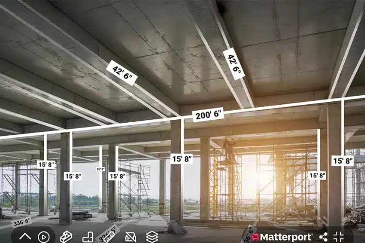
Experium’s 3D virtual tours deliver high-quality, visually corrected imaging suitable for general measurements and space planning. They should not be viewed as a substitute for high-precision laser scanning. If your project requires very tight accuracy (such as 2–4 mm tolerance), we recommend combining the virtual tour with additional capture methods.
Data extracted from the virtual tour can include E57 point clouds, colourised 3D models, 3D BIM files, and visual presentation models. These deliverables support design, coordination, and project execution across all stages of construction.
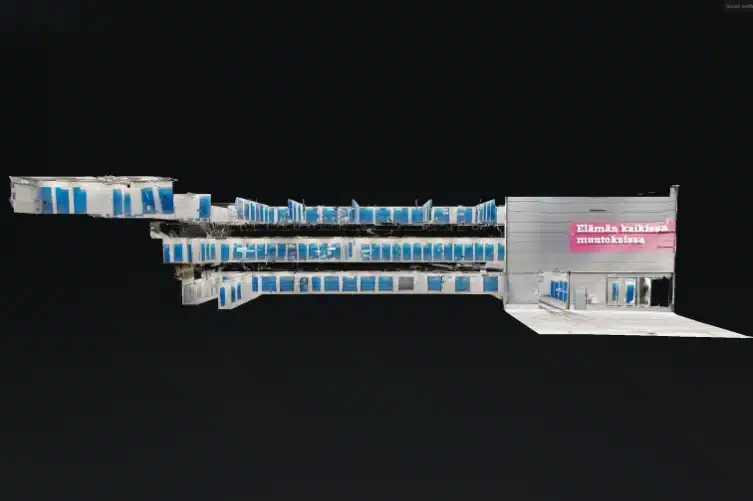
Experium created a 3D virtual model of self-storage facilities for Cityvarasto in Jakomäki, Helsinki. The model is used to support customer communication, remote facility management, internal documentation, and detailed planning. The scan accurately visualizes routes, unit locations, and spatial layouts.
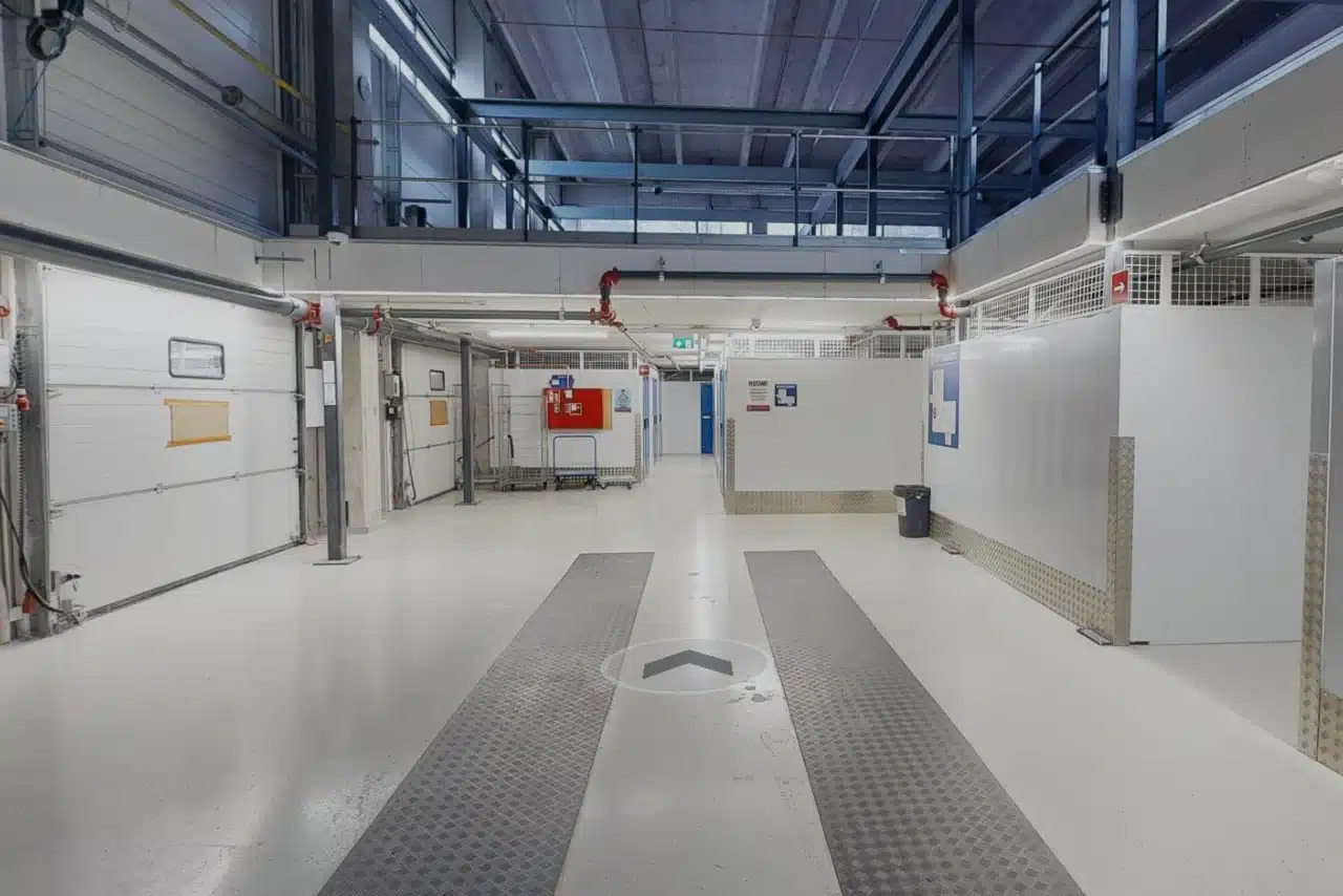
Experium scanned a three-story, 1,100 m² storage facility in Pitäjänmäki, Helsinki. The 3D model is used for asset management, monitoring, documenting space configurations, and remote inspections. It visualizes unit locations, circulation routes, and shared areas, improving data accessibility and management at the property level.
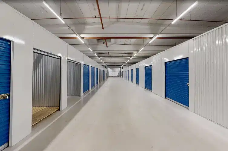
Experium scanned a 3,100 m² storage facility in Ahjo, Kerava. The virtual model supports remote facility management, internal planning, and documentation. The 3D view provides a comprehensive visualization of unit layouts, circulation paths, and shared spaces, enhancing communication between departments and improving overall spatial understanding.
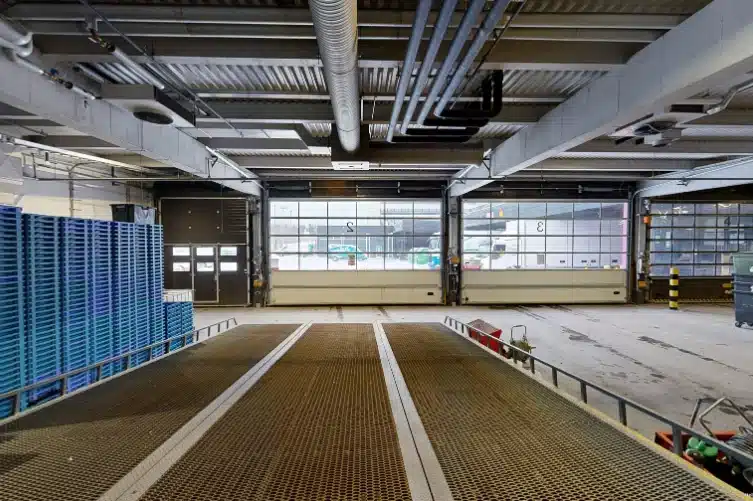
Experium scanned a two-story, 2,316 m² storage facility in Kaivoksela, Vantaa. The 3D virtual model supports remote facility management and planning, providing a precise visual view of unit layouts, circulation routes, and the loading area.
Experium provides drone and 3D scanning services across Finland, carrying out projects in Helsinki, Tampere, Turku, Jyväskylä, and throughout the country, wherever data is required.
We support projects in both urban environments and more remote locations. Please submit a description of your project — we will contact you within 24 hours.
For urgent enquiries, please call us directly.