EXPERIUM PROJECT REFERENCE
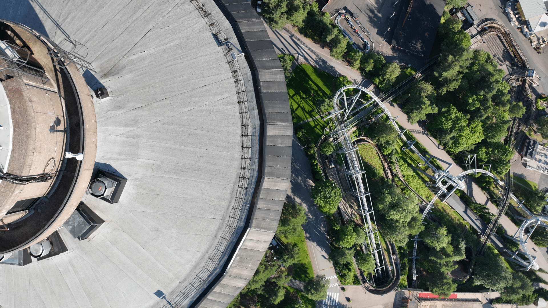
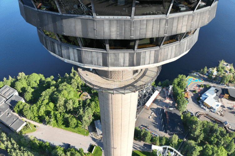
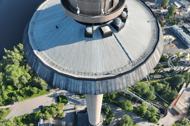
Experium carried out survey-grade 3D documentation of Tampere Finland’s tallest observation tower at 168 meters. The project produced centimeter-accurate aerial data, providing Tampere City Planning with reliable 3D documentation to support urban development and geospatial analysis needs.
To produce highly accurate 3D data of the 168m observation tower ensuring complete structural coverage. The data must be suitable for digital 3D modeling to support Tampere’s urban planning needs.
Drone mapping the observation tower demanded coordination between multiple parties and careful flight planning and survey-grade precision due to its height, location, and operational environment.
Experium employed survey-grade drone mapping technology and structured flight planning to capture the observation tower with centimeter-level positional accuracy, delivering a dataset suitable for high-fidelity 3D modeling and urban planning.
The completed project by Experium delivered a high-precision aerial dataset of the observation tower. The results extended beyond immediate modeling needs, creating a long-term geospatial reference that supports development and ongoing infrastructure management.
Experium’s 3D modeling data of the observation tower demonstrates how drone technology can generate long-term value from even the most complex urban landmarks, delivering accuracy, reliability, and practical benefits.
Experium provides drone and 3D scanning services across Finland, carrying out projects in Helsinki, Tampere, Turku, Jyväskylä, and throughout the country, wherever data is required.
We support projects in both urban environments and more remote locations. Please submit a description of your project — we will contact you within 24 hours.
For urgent enquiries, please call us directly.